
Communication Builds Our Community
Communication Builds Our Community
Activity Increasing Over Distant Ocean May Creep Westward
After a surprisingly quiet August ion the tropics, forecasters are watching several systems as the historic peak of the Atlantic Hurricane season arrives.
The formation of Tropical Storm Francine in the Gulf of Mexico has coastal residents on alert, but that system should leave Florida unscathed as it moves generally northward, potentially impacting Louisiana at Hurricane force,
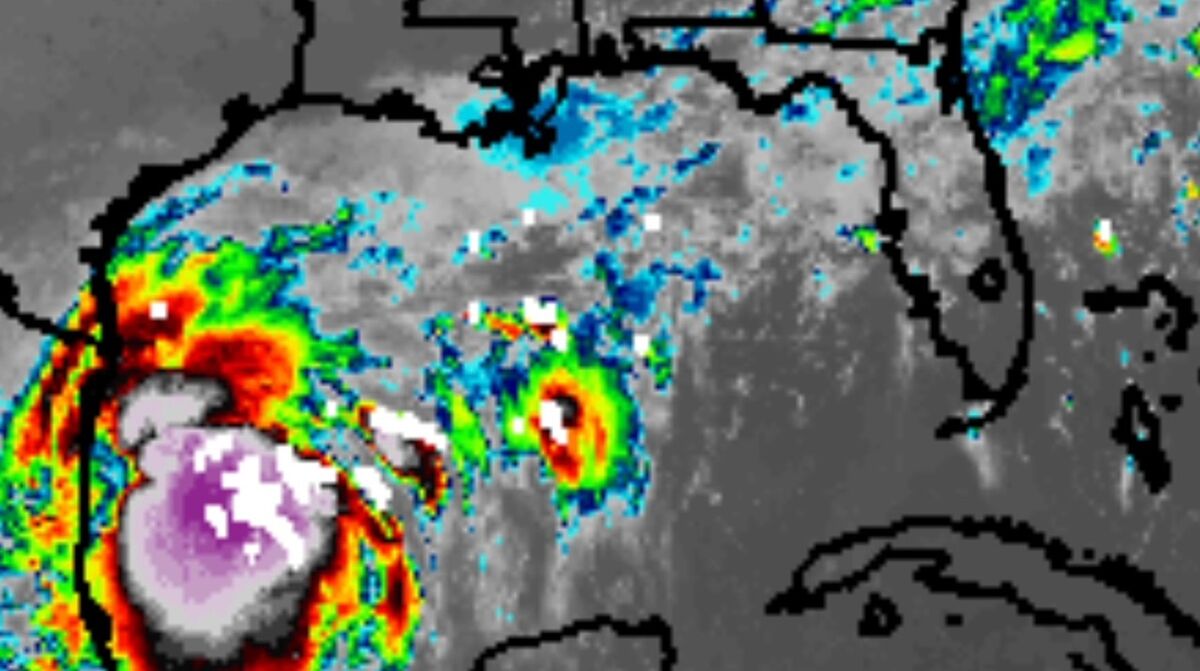
A disturbance expected to grow into Tropical Storm Francine today could impact Louisiana as a hurricane later this week. For Florida, attention remains on the Atlantic, where Cabo Verde storms are forming.
For Florida, attention is directed to the distant Atlantic, where a parade of tropical waves and a broad area of low pressure could spawn two or more cyclones in coming days. The first of those is expected to eventually move northward without entering the Caribbean, but a trailing system may become a worry for the state by mid-September. The region off the African coast around the Cabo Verde islands is the source of the often-powerful storms.
September 10 is the date cited as the historic peak of the Atlantic Hurricane season, and the anniversary of powerful Hurricane Donna 64 years ago. That storm devastated much of the state, leaving much of Polk County without electric service for up to two weeks.
Despite forecasts of extreme levels of Hurricane activity this season, actual numbers have remained lower than normal, although Hurricane Beryl, an anomalous early-season African-origin storm, reached Category Five on the Saffir-Simpson scale of Hurricane intensity, reaching sustained wind speeds of 160 miles per hour. It carved a path through the Caribbean and across the Yucatan Peninsula before slamming Texas and leaving a trail fo devastating flooding northeast into New England.
Water temperatures in both the Gulf of Mexico and Atlantic Ocean are well above historic numbers, providing abundant fuel for storms. Only persistently-unfavorable winds have prevented the formation of more hurricanes. As the six-month Hurricane season progresses, meteorologists and climatologists are expecting the development of strong La Nina conditions in the Pacific Ocean Basin, which would lend to favorable conditions for storms to form in the Atlantic by reducing the wind shear that often tears young storms apart.
As always, Floridians should have a Hurricane plan based upon the strength and elevation of their homes, determining whether they should evacuate or shelter in place during a storm. An adequate supply of food, medicine, and drinking water are high on the list of preparations that should always be at hand.


Reader Comments(0)