
Communication Builds Our Community
Communication Builds Our Community
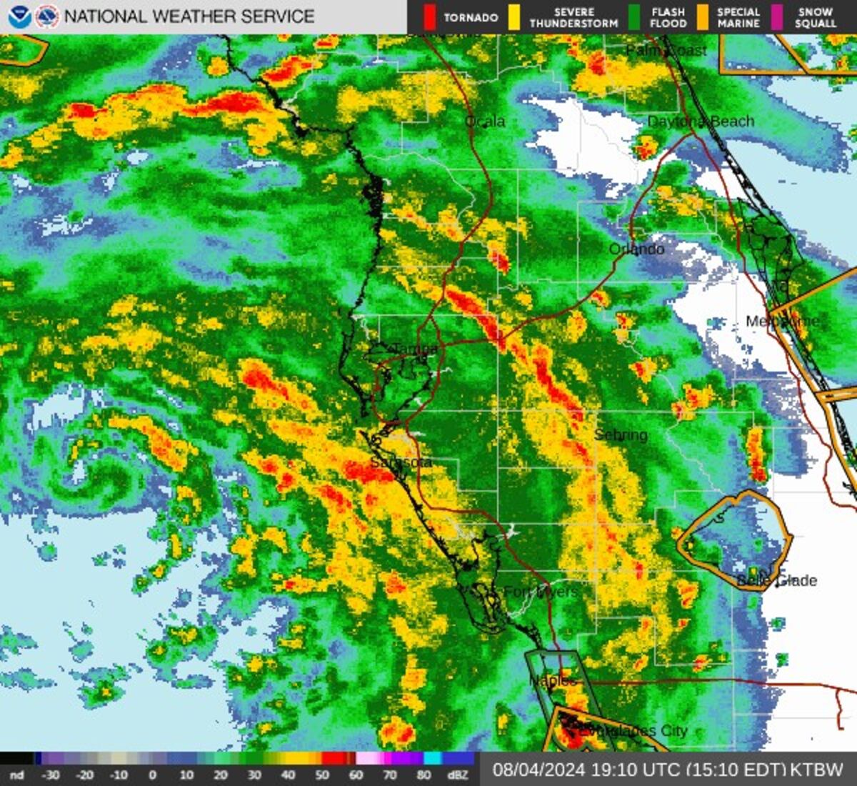
A strong feeder-band of storms is expected to pass over the Ridge area beginning about 3:45, with possible tornados and very gusty winds accompanied by heavy rains. Those needing to travel are encouraged to wait out the storms which should clear the area in about an hour.
The heavy band of rain has already cleared the Bartow and Fort Meade area, where a rotation was detected by Doppler radar. An earlier funnel cloud was seen by multiple witnesses as it passed over Lake Wales, apparently without touching down.
The squalls are part of the right flank of Tropical Storm Debby, which is intensifying over the Gulf of Mexico. Hurricane and Tropical Storm Warnings are flying for most of Florida's west coast. A Tornado Watch is up for most of the Florida peninsula, and warnings have been raised for several individual cities and towns due to fast spin-up rotations detected by Doppler radar.
Official forecasts predict that Polk County and the Ridge area can expect two to four inches of rain from the system, with the bulk of that falling during the passing squalls of "feeder" bands. Residents should be alert for rapidly-changing conditions as the individual storm cells race northward, often generating strong downburst winds and very heavy rains.
Anyone detecting wind damage or flooding impacts from the storm are encouraged to report them to news@lakewalesnews.net.


Reader Comments(0)