
Communication Builds Our Community
Communication Builds Our Community
Forecasters and Models Eye New System Formation That May Threaten Florida
After a lull of several weeks without even a tropical depression, let alone a named storm, the Atlantic Hurricane Season is heating up again. August and September form the heart of the storm season, which peaks around September 10, according to historical records.
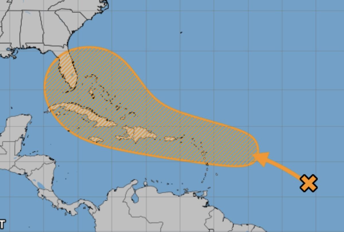
A long-range forecast from the National Hurricane Center foresees the potential formation of a new system that could affect Florida within the next week to ten days. i
Forecasters and computer models have alerted to the possible formation of a new cyclone this week in the vicinity of the Antilles. If the storm forms there, it is likely to track in the general direction of the Bahamas and Florida.
Although numerous models are depicting the formation of a new storm in that area, there is no consensus of future tracks. Some take the system northward through the Bahamas, while others bring a strengthening storm into the Gulf of Mexico along Florida's west coast.
Conditions in the Atlantic basin have become more favorable for the formation of storms as the powerful Bermuda High, an area of higher pressure centered over the ocean, has weakened and retreated farther north. Upper-level winds have also become light and variable, eliminating the shearing effect that often pulls developing systems apart.
Conditions have become very favorable for the rapid intensification of cyclones as ocean water temperatures have risen over the past few years and are now at or near record levels in many area. That excess heat, released as water vapor, provides fuel for the storms.
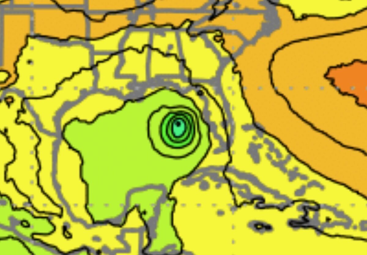
A Canadian weather modeling computer depicts a cyclone just west of Florida on August 5. Floridians should remain vigilant during the entire hurricane season.
The weaker effect of the Bermuda High pressure has also set conditions for slow-moving thunderstorms over Florida, causing isolated heavy rains. A storm Saturday night left an inch of rain, and two inches in some locations, over a swath of southeastern Polk from Frostproof to the east side of Lake Wales, while other areas saw only light rains.
As always, area residents should remain prepared for a storm and potential power outages. A supply of ready-to-eat canned goods, battery-powered lighting and needed medicines should be at hand.
As a storm approaches, it is recommended that freezers and refrigerators be filled to capacity with jugs and bottles of water to help keep them cold in case of loss of power, as well as to provide a guaranteed source of drinking water in case of contamination of supplies.


Reader Comments(0)