Sorted by date Results 26 - 50 of 132

After a surprisingly quiet August ion the tropics, forecasters are watching several systems as the historic peak of the Atlantic hurricane season arrives. The formation of Tropical Storm Francine in the Gulf of Mexico has coastal residents on alert, but that system should leave Florida unscathed as it moves generally northward, potentially impacting Louisiana at hurricane force, For Florida, attention is directed to the distant Atlantic, where a parade of tropical waves and a...
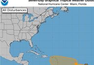
After a long lull that has stymied forecaster's predictions of a hyper-active hurricane season, the tropics are once again heating up. A new disturbance heading westward across the central Atlantic is expected to pass across the Windward Islands and potentially threaten the United States. According to forecasters, the system is presently poorly-organized but has been given a 40% chance to develop into a tropical cyclone by the National Hurricane Center. If it does it would be...

The storm came in a destructive rush, defying predictions, and caught most Polk residents completely off-guard. When it had passed, Hurricane Charley had left a trail of incredible destruction in its wake. It was a Friday, the 13th of August, twenty years ago this week that the first hurricane in 44 years struck southeast Polk. It's a date that many who experienced the storm will never forget. In a matter of about two hours the fast-moving storm damaged virtually every...
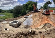
A new road closure will require long detours for yet more motorists in eastern Polk County, while other projects extend well beyond their announced completions. Drainage upgrades will close Timberlane Road just south of the intersection with Canal Road northeast of Lake Wales beginning Thursday, August 8. The work is scheduled to take two weeks. The cross drains beneath the roadway leading to Lake Pierce are being replaced ahead of a county project to resurface Timberlane...
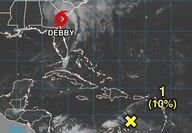
The Ridge area and southeastern Polk generally escaped damage during the passage of Hurricane Debby to the west of the peninsula, but the tropics remain active, with yet another disturbance following in the path of the recent storm. Unlike areas along the coast that saw serious flooding from both heavy rains and storm surge, the local area generally avoided problems with high water. Rainfall totals across the area generally fell in the six-to-eight inch category during the pas...
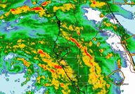
A strong feeder-band of storms is expected to pass over the Ridge area beginning about 3:45, with possible tornados and very gusty winds accompanied by heavy rains. Those needing to travel are encouraged to wait out the storms which should clear the area in about an hour. The heavy band of rain has already cleared the Bartow and Fort Meade area, where a rotation was detected by Doppler radar. An earlier funnel cloud was seen by multiple witnesses as it passed over Lake Wales,...
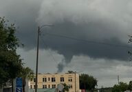
Heavy squalls passing through the Lake Wales area early Sunday afternoon generated a funnel cloud that hovered over Lake Wales. If was unconfirmed if it had touched the ground at any point during its south-to-north passage over the city, although there were numerous reports of very strong wind bursts from north of Crooked Lake to the city's north side. The squalls are part of the right flank of Tropical Storm Debby, which is intensifying over the Gulf of Mexico. Hurricane and...
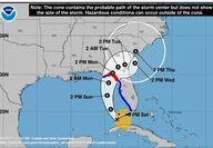
Heavy rains southeast Polk and the Ridge area may be accompanied by gusty winds on Sunday and Monday as Tropical Storm Debby. currently located near Cuba will affect Florida's weather. The current forecast keeps the center of newly-designated Tropical Storm Debby away from the Tampa Bay area over the Gulf, reaching the coast only in the Big Bend area. The National Hurricane Center in Miami is projecting that the Debby will reach hurricane strength as it passes over the very...
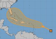
After a lull of several weeks without even a tropical depression, let alone a named storm, the Atlantic Hurricane Season is heating up again. August and September form the heart of the storm season, which peaks around September 10, according to historical records. Forecasters and computer models have alerted to the possible formation of a new cyclone this week in the vicinity of the Antilles. If the storm forms there, it is likely to track in the general direction of the...
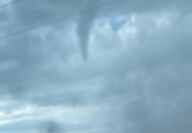
An apparent tornado spawned by a line of strong thunderstorms touched down in the Alturas area Tuesday around 5:30 p.m. Luckily the funnel struck in a rural, agricultural area and there were no immediate reports of damage or injuries. Witnesses traveling along the Alturas-Babson Park Cutoff Road, often referred to locally as "ABC" road, saw the funnel moving through the sky, and photos show it stirring up a cloud of condensation and debris at ground level. The funnel appeared...
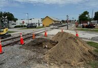
The closure of SR 17 (Scenic Highway) at Hillcrest Avenue, originally announced as a 30-day project, is expected to continue well after the beginning of the school year, forcing additional traffic onto South 4th Street past McLaughlin Middle-High School. Crews closed Scenic Highway from Grove Avenue to Hillcrest Avenue in June to begin installing new drainage structures. Sidewalks in the area are also detoured. According to the Florida Department of Transportation, the...

After a typically-slow start to the Hurricane season, things are beginning to move into an active phase in the tropics, a reminder to all that preparing for storm season should be well underway. NOAA's National Hurricane Center in Miami is alerting on the development of Hurricane Beryl in the mid-Atlantic, an unusual area for this point in the season. The storm is expected to intensify to become a major hurricane before reaching the southern Windward Islands. Long-range...

After a serious months-long drought that saw falling lake levels and withered lawns and shrubs, southeast Polk and the entire region are finally expecting to see the start of the normal summer monsoon rains. Forecasts are calling for as much as 2" to 3" of rain in some locations on a daily basis this week, with areas that see repeated rounds expected to incur localized flooding. A saturated atmosphere and light steering winds will lead to the development of thunderstorms...
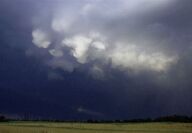
With much of central Florida in a serious drought situation and wildfires becoming a growing threat, forecasters are at last predicting a potential start to the normal summer rainy season. Conditions across the Atlantic and Gulf of Mexico will begin to normalize over the coming week as the "Bermuda High," a sprawling moisture pump that feeds moist tropical air northward to Florida, beginning to set up in the Atlantic. At the same time, a persistent high-pressure area that has...

The Lake Wales region is now officially in a drought status after conditions here worsened during the past week. Excessive heat during April and May have increased stress on agriculture and native landscapes. According to the official U.S. Drought Monitor, conditions here worsened from Abnormally Dry (D0) to Moderate Drought (D1), according to this week's U.S. Drought Monitor. The Climate Prediction Center's May Drought Outlook released on April 30, 2024, had predicted that...

The drought and intense heatwave that has gripped the Ridge and most of central Florida has led Polk County to declare an outdoor burn ban which will go into effect next week. The move comes just as the 2024 hurricane season begins. The annual six-month cyclone season is predicted to be far more active than normal by the National Oceanic and Atmospheric Administration (NOAA) and a host of private weather predictions. NOAA's Climate Prediction Center has released a forecast...

Perhaps Benjamin Franklin said it best: "By failing to prepare, you're preparing to fail." As we approach the beginning of the 2024 Atlantic Hurricane Season (June 1 - November 30), the Florida Governmental Utility Authority (FGUA) urges all Floridian's to heed these words of wisdom. May 5 – 11 is National Hurricane Preparedness Week, an opportunity to focus our collective efforts on the potentially lifesaving benefits of planning and preparation. The threat this year is g...

If forecasters are correct, Floridians should expect and prepare for a very active and threatening hurricane season for 2024. Reports from private forecasters are already sounding alarms about the sharply-elevated water temperatures in the waters of the Atlantic, Caribbean, and Gulf of Mexico. That heat, released as steamy air, is condensed and cooled in the heart of hurricanes, falling as torrential rain and creating the lowered pressure that drives the intensity of the...

Construction of a new sewer main and lift station will require the closure of Sunshine Drive in the Crooked Lake Park neighborhood south of Lake Wales for two months starting Monday, December 4. Sunshine Drive will be closed to through traffic at the intersection with U.S. Highway 27. Sunshine Drive residents can access their homes via connecting crossroads from First Avenue North. Minor backups and delays at the First Avenue North and U.S. Highway 27 intersection are possible...

Even as the Lake Wales area enjoys pleasant and mild weather, it's important to keep a weather-eye out for late-developing tropical storms and hurricanes that could threaten to disrupt our idyllic autumn days. Now two long-range models are depicting just such a potential. Hurricane season runs through November 30, and there have been occasional storms that have developed even after that date. The unusually-warm water in the Atlantic basin, coupled with unseasonable warmth,...

It's time to start digging out the jackets and sweaters. The long-awaited seasonal cooldown after the end of an exceptionally hot summer will arrive in earnest next week after the passage of a series of reinforcing cold fronts. Heavy rains are expected over Florida beginning Wednesday night, and rain will linger for several days before a series of fronts sweeps in a colder air mass that will leave morning lows in the 50's for the Lake Wales Ridge area. The potential for...

An early-autumn bout of very soggy weather has left the Lake Wales Ridge area with as much as nine inches of rain in some locations, raising lake levels and saturating marshes. Now long-range models are beginning to depict a weather pattern favorable to tropical storm development in the western Caribbean. The wet weather has generally been welcomed across central Florida after a drier-than-normal year, and the various models are in agreement that the pattern will remain in...

After a two-day spell of autumn-like weather to mark the official start of the season this weekend, summer-like rains are expected to return to Florida, but the threat of a tropical storm or hurricane remains distant. Computer models are showing a benign pattern remaining over the central Atlantic basin, with protective upper-level winds deflecting storms northward and away from Florida. After the rapid pop-up of Tropical Storm Ophelia just off the east coast of Florida last...

As the 2023 hurricane season peaks this week, storm threats to Florida appear to be at low ebb. Conditions in the tropical Atlantic basin are continuing to deflect storms northward. As once powerful Hurricane Lee makes landfall on the coasts of Maine and Nove Scotia, Floridians breathed a sigh of relief. At is peak the storm reached the much-feared Category Five intensity, but Florida received nothing more than dangerously high surf and beach erosion. This week the first of a...

While multiple named storms have swirled harmlessly all week in the mid-Atlantic, a weak tropical wave that emerged off the coast of Africa several days ago is now the system to watch for Florida. The National Hurricane Center in Miami is now assigning the system a near-100 percent chance of development during the coming three days, during which time it is forecast to be approaching the area of the Virgin Islands. By that time it should be a powerful hurricane. Despite still...